-
 Karstology
-
 ECS
ECS
-
 Ileostomy
-
 Model organism
-
 Psycho-oncologist
-
 MVIC
MVIC
-
 Permanent virtual circuit
-
 S-Video
-
 Cryogenian
-
 Sessile
-
 InnoDB
-
 Cryptography
-
 Elongation
-
 FDD
FDD
-
 Grassy tanne
-
 Balneotherapy
-
 Glottis
-
 Gibberellins
-
 Soda straws
-
 Aral sea
-
 Procambium
-
 Edge
Edge
-
 Oblique illumination microscope
-
 Frenulum
-
 Mineral variety
-
 Urothelial
-
 Hovering
-
 Oven
Oven
-
 Barycentric
-
 Wingless
ENVISAT
Envisat is an advanced remote sensing satellite in polar orbit, which provides measurements of the Earth (atmosphere, oceans, ice, and land areas). The instruments on board Envisat, such as MERIS, are innovating and ambitious; they continue and develop the scientific and practical objectives of the two previous missions, ERS-1 and ERS-2.
The Envisat data is primarily a support for Earth sciences, allowing changes in the environment and the climate to be monitored.
Envisat was launched in March 2002.
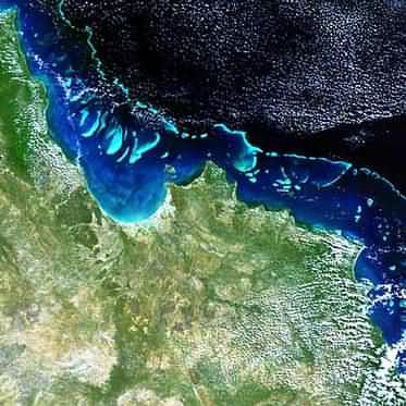
 The Great Barrier Reef seen by Envisat
Latest
Fill out my online form.


