-
 Riparian forest
-
 Genotype
-
 Individual heating
-
 Polling
-
 Hipparcos
-
 Bearer service
-
 Asparagine
-
 Adsorptivity
-
 Volcanic rock
-
 URL
URL
-
 Truncation
-
 Bar
Bar
-
 Shared resource radio network
-
 Magnetosphere
-
 Excoriation
-
 Reptile
-
 Anti-oxidant
-
 Debugger
-
 Hydrogel
-
 tRNA
tRNA
-
 Datamining
-
 Essential nutrient
-
 TAC
TAC
-
 Defecation
-
 Hot-tub
-
 rRNA
rRNA
-
 Organic agriculture
-
 Tholin
-
 Oort cloud
-
 Lift augmentation system
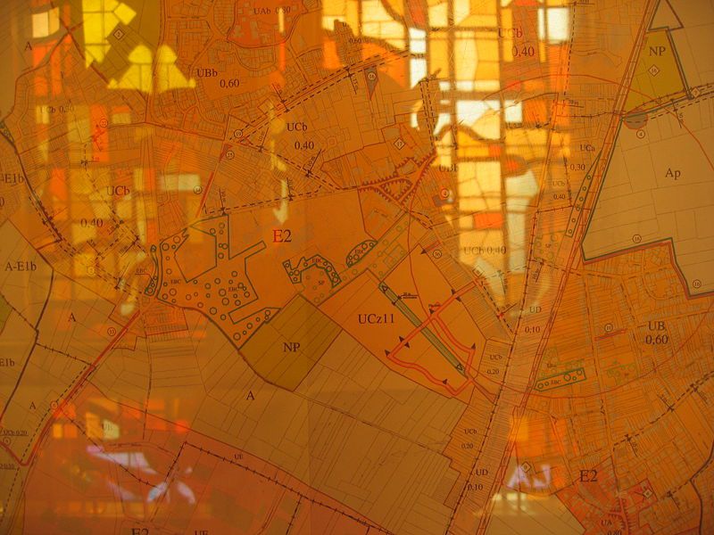
Local zoning plan
In France, a plan local d'urbanisme (PLU, local zoning plan) is a document used in town planning. The 2000 Loi de solidarité et de renouvellement urbains (SRU, Solidarity and urban renewal act) replaced the former Plan d'occupation des sols (POS, Land occupation plan).
The PLU defines the main directions for town planning in a council district or in a group of council districts in a comprehensive zoning project.
What does the local zoning plan consist of?
After a public inquiry, the PLU includes:
- a project presentation with an analysis of the land and justification of the choices made;
- a sustainable development and construction plan (projet d'aménagement et de développement durable or PADD in French) that describes the urban, economic, social and environmental development plan for the local region over the next 10 to 20 years;
- land use regulations and a map of the intended uses of different areas in the town's territory (areas for urbanisation are marked as U, agricultural areas are marked as A, etc.) which can be enforced against third parties;
- in some cases, an environmental assessment, if the PLU is likely to impact the environment;
- annexes (easements, risk management, etc.).
Naturally, the local zoning plan must be compatible with the land use planning and development documents defined for the wider territory.
This is particularly the case for the urban master plan (schéma de cohérence territorial or SCoT in French), regional or national natural park charters, strategic plans for water management and development (SDAGE) and plans for development and water management (SAGE) or even urban transport plans (PDU).
 A zoning map for the Wattignies local zoning plan, displayed in Wattignies Town Hall. © Coin-Coin, Wikimedia public domain
Latest
Fill out my online form.


